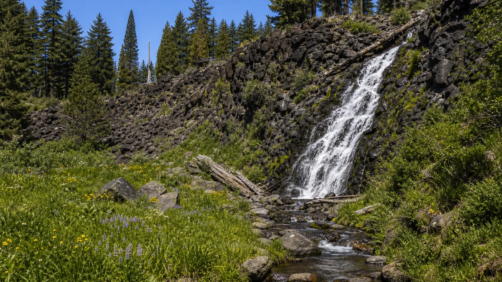
Sunriver, Oregon
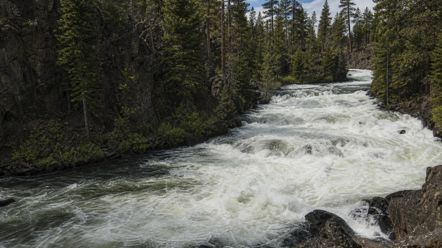
Benham Falls
Plan Benham Falls near Sunriver, Oregon: 1.4 mi route details, parking and directions, best time to visit, safety notes, and 8 waterfall photos.
height not listed1.4 mi8 photos
Practical guides to seven Oregon waterfalls, from a 249-foot Columbia Gorge plunge to a Crater Lake spring-fed meadow cascade. Verified parking fees, trail lengths, seasonal closures, and access notes against USFS, Oregon Parks, and NPS sources.
Oregon is the country's densest waterfall state per square mile, a function of three overlapping geologies: the Columbia River Basalt Group flows that draped the north and east of the state between 17 and 6 million years ago, the younger Western Cascades and High Cascades volcanics that built Mount Hood, Mount Mazama, and the Three Sisters, and the soft Tyee Formation sandstone of the Oregon Coast Range. Wherever those rocks meet running water and a step in topography, the state produces a waterfall, and the official count exceeds 230 named falls (the Oregon Department of Transportation and Northwest Waterfall Survey list well over a thousand if you include unnamed drops).
The Columbia River Gorge is the most concentrated stretch. Roughly 90 falls sit within a 30-mile reach east of Portland, including 620-foot Multnomah Falls, which is the tallest year-round waterfall in Oregon and the most visited natural feature in the state. South of the Gorge, the Western Cascades and the North Umpqua River corridor hold the tallest single-drop falls, including 272-foot Watson Falls and 286-foot Salt Creek Falls. The Coast Range adds short, lush rainforest plunges that run hardest December through April, and Central Oregon's upper Deschutes River produces a different kind of waterfall: stepped basalt rapids inside Newberry Volcanic Monument rather than vertical curtains.
This hub indexes the seven Oregon waterfall guides published on Waterfalls Guide so far. They span six regions and five distinct rock types, from the chartreuse-lichen Latourell columns in the Gorge to a Crater Lake spring-fed cascade rising out of the Pumice Desert aquifer. Each guide carries practical access detail (trail length, parking fees, gate dates, dog rules) verified against the U.S. Forest Service, Oregon Parks and Recreation, and the National Park Service.
A 249-foot single-drop plunge against an undercut wall of columnar Grande Ronde basalt streaked with chartreuse-yellow lichen, reached by a half-mile walk in Guy W. Talbot State Park about 30 minutes east of Portland.
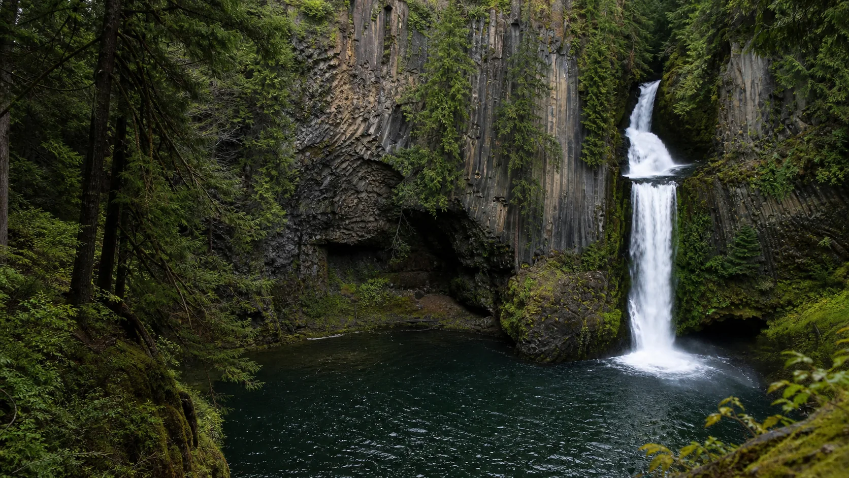
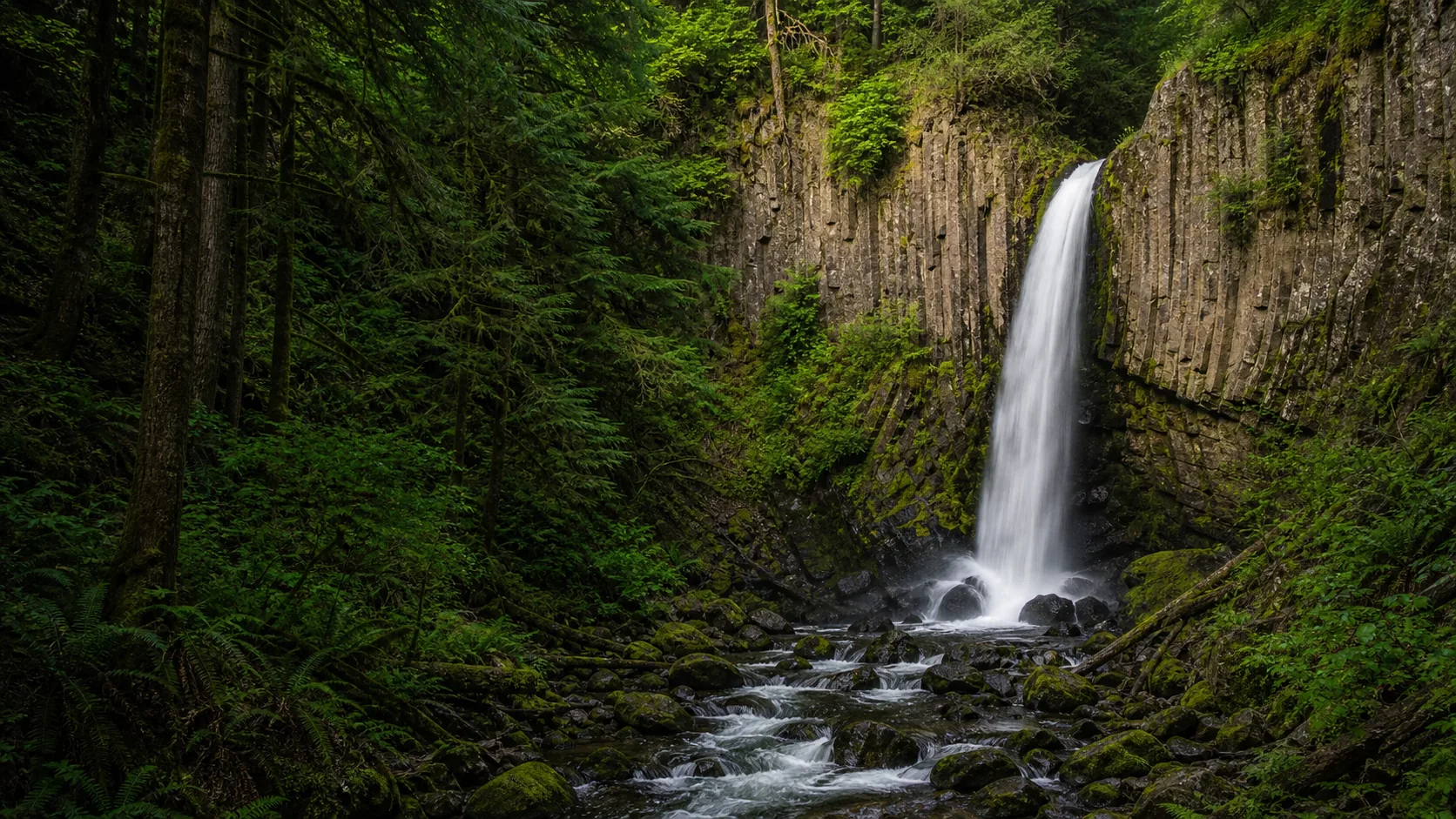
Two tiers of plunge into a tight basalt amphitheater on the North Umpqua, reached by a 0.4-mile trail with roughly 200 cedar stairs and a viewing deck that gives the postcard frame in under 20 minutes.
A 240-foot steel suspension bridge hangs 100 feet above the gorge directly downstream of the 75-foot Tyee Sandstone plunge, on a 3-mile round trip inside the Siuslaw National Forest 17 miles southeast of Lincoln City.
Oregon's waterfalls run on three clocks. The Columbia Gorge and Coast Range are rain-driven and peak November through April, with the loudest flow typically in late December and January after a stacked atmospheric-river week. Cascade falls fed by snowmelt (Watson, Toketee, Plaikni) peak late May through early July and hold respectable flow through August because the volcanic aquifer keeps base flow high. Central Oregon's Deschutes River features (Benham, Dillon) run year-round but are most dramatic March through May when Cascade snowmelt is still moving through the system.
Two access constraints worth planning around: Crater Lake's Pinnacles Road (the access spur for Plaikni Falls) is closed by snow from roughly mid-October through late June, and White River Falls State Park closes its gate from mid-October through late April. Gorge waterfalls and the North Umpqua corridor are accessible year-round, though winter storms can knock out US-26 and OR-138 for short windows.
Roughly 90 named waterfalls sit within a 30-mile reach east of Portland along the Historic Columbia River Highway and I-84, all dropping over Columbia River Basalt Group flows. Latourell is the westernmost of the major falls; Multnomah, Wahkeena, Bridal Veil, Horsetail, and Oneonta continue east along the same corridor.
Oregon Route 138 east of Roseburg threads the North Umpqua River past more than a dozen named falls in roughly 40 miles. Toketee and Watson sit within a few miles of each other and are nearly always visited together; Salt Creek Falls (286 ft) is 30 miles east on OR-58 as the natural third stop.
Coast Range falls drop through soft Tyee Formation sandstone in dense Sitka spruce and western hemlock rainforest. They are rain-driven, peak from late fall through early spring, and the trails stay green and mossy year-round.
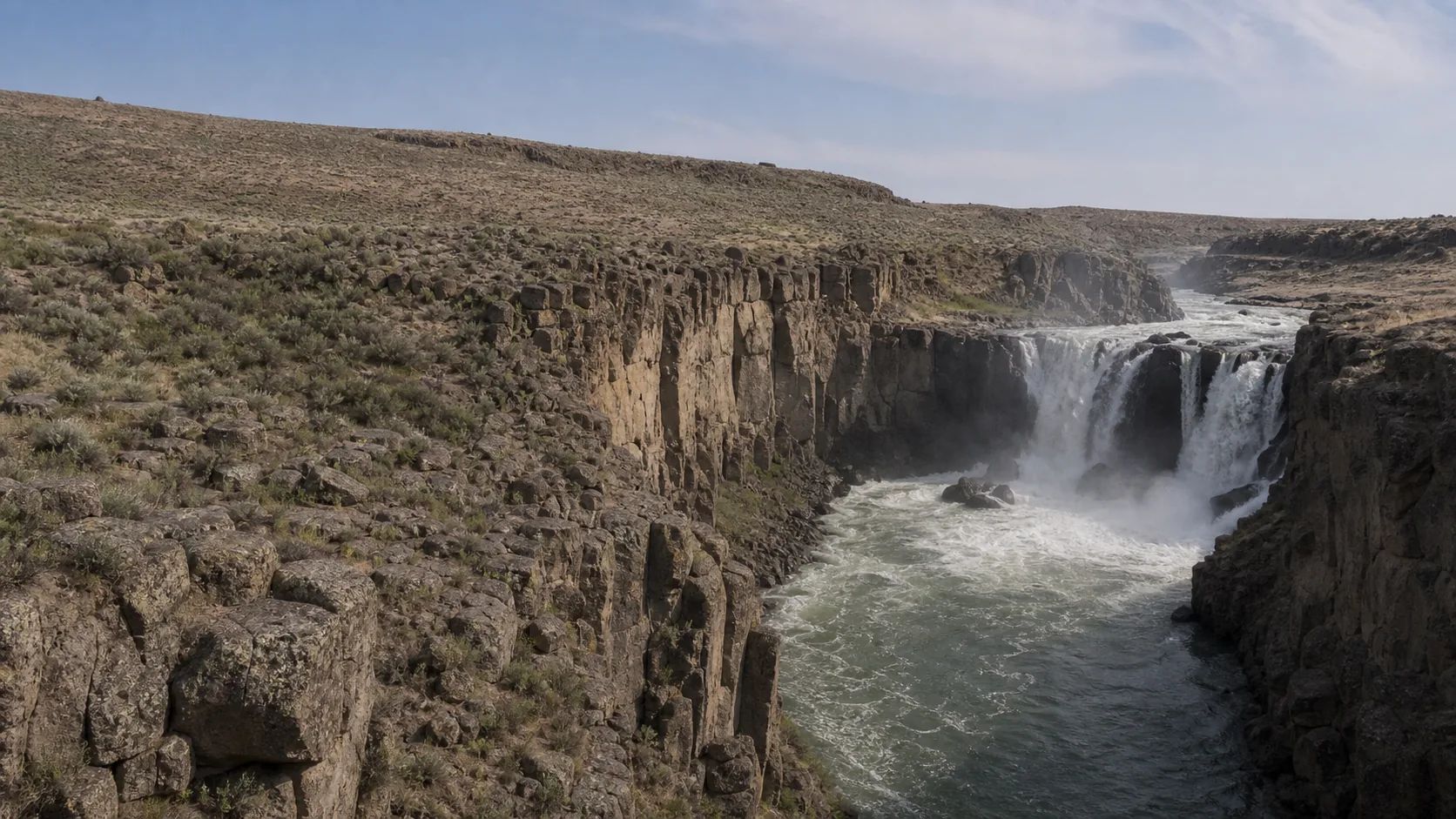
The upper Deschutes River between Sunriver and Bend cuts through a 6,000-year-old Lava Butte basalt flow, producing stepped Class V rapids rather than vertical plunges. Benham, Dillon, and Lava Island Falls all sit along the Deschutes River Trail inside Newberry National Volcanic Monument.
Two very different Cascade falls. Plaikni is a 20-foot spring-fed cascade rising out of Crater Lake's Pumice Desert aquifer, accessible only when Pinnacles Road opens in late June. White River Falls is a 90-foot Columbia River Basalt plunge on Mt Hood glacial meltwater near Tygh Valley, with 1910 hydroelectric plant masonry ruins still standing at the base.
Oregon has more than 230 officially named waterfalls and well over a thousand if unnamed drops are counted, per the Northwest Waterfall Survey. Roughly 90 of the named falls sit within a 30-mile stretch of the Columbia River Gorge, the densest waterfall corridor in the United States. Silver Falls State Park, southeast of Salem, holds another 10 named falls within a single 8.7-mile loop.
Multnomah Falls is the tallest year-round waterfall in Oregon at 620 feet across two tiers (542-foot upper drop plus a 69-foot lower drop), and it is the most visited natural site in the state. The tallest single-drop waterfall in Oregon is contested between Watson Falls (272 feet) and several other candidates; the Northwest Waterfall Survey lists 286-foot Salt Creek Falls on OR-58 as taller than Watson by most measurement methods.
It depends on the region. Columbia Gorge and Coast Range falls peak November through April from Pacific Northwest rain, with the loudest flow typically in late December and January. Cascade snowmelt falls (Watson, Toketee, Plaikni) peak late May through early July. Central Oregon's Deschutes River features run year-round but are most dramatic March through May. Plan around two specific closures: Crater Lake's Pinnacles Road shuts roughly mid-October through late June for snow, and White River Falls State Park closes its gate mid-October through late April.
Most are free to enter. Oregon State Parks waterfalls (Latourell, White River, Silver Falls) charge no entry fee, though Silver Falls has a $5 day-use parking fee. U.S. Forest Service waterfalls on the North Umpqua and in Central Oregon (Toketee, Watson, Benham, Drift Creek) require either a $5 per-vehicle day pass or a Northwest Forest Pass at the trailhead. Crater Lake National Park, where Plaikni Falls sits, charges a $30 per-vehicle entrance fee that covers seven days. Multnomah Falls is free but requires a timed-entry permit between Memorial Day and Labor Day under the current Forest Service pilot.
Some, but not most of the headline guides on this hub. Swimming is explicitly prohibited or unsafe at Benham Falls (Class V rapid in a basalt gorge), Latourell Falls (rockfall hazard, signed closure), and Watson Falls (no formal pool). Toketee Falls has no legal access to the pool below the falls. White River Falls and Drift Creek Falls have downstream pools that some visitors use at their own risk, with no lifeguards. For Oregon waterfall swimming the standard destinations are Tamolitch Blue Pool on the McKenzie River, the Punchbowl on the Sandy River, and the upper Salt Creek above Salt Creek Falls.
The Columbia River Gorge waterfall corridor is a 30-mile stretch of the Oregon side of the Columbia River, east of Portland between Troutdale and Cascade Locks, where roughly 90 named waterfalls drop off the Columbia River Basalt Group cliffs into the river. The Historic Columbia River Highway (US-30) threads the corridor and gives shoulder pullouts at most of the major falls. Multnomah, Wahkeena, Bridal Veil, Horsetail, Oneonta, and Latourell are the most photographed; less-visited falls like Elowah, Upper McCord Creek, and Punch Bowl Falls require short hikes. The corridor sits inside the Columbia River Gorge National Scenic Area, managed jointly by the U.S. Forest Service and Oregon Parks and Recreation.
Plan Benham Falls near Sunriver, Oregon: 1.4 mi route details, parking and directions, best time to visit, safety notes, and 8 waterfall photos.
Plan Drift Creek Falls in Lincoln County, Oregon: 3 mi route details, parking and directions, best time to visit, safety notes, and 4 waterfall photos.
Plan Latourell Falls in Multnomah County, Oregon: 2.4 mi route details, parking and directions, best time to visit, safety notes, and 8 waterfall photos.
Plan Plaikni Falls near Crater Lake National Park, Oregon: 2 mi route details, parking and directions, best time to visit, safety notes, and 8 waterfall photos.
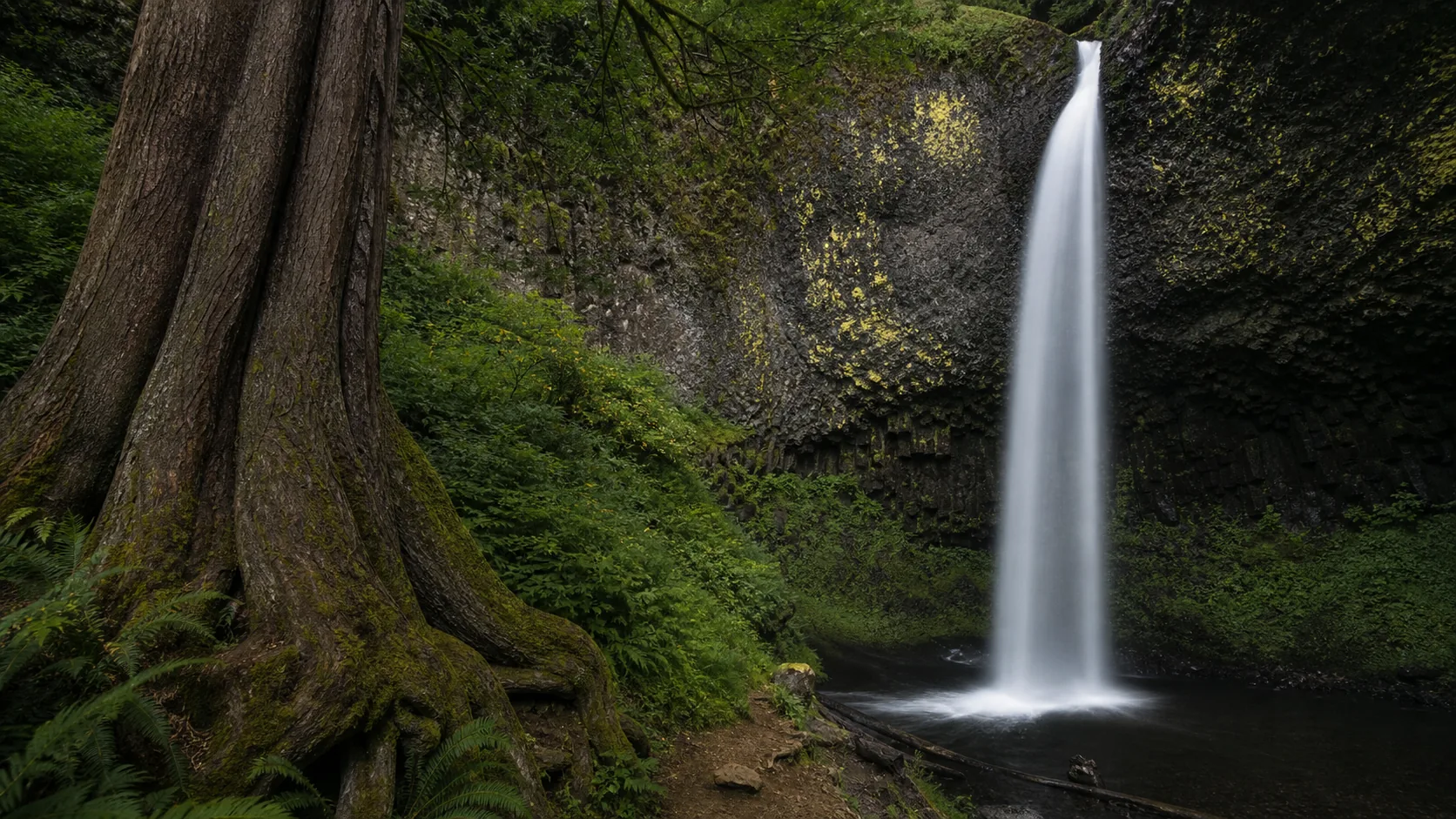
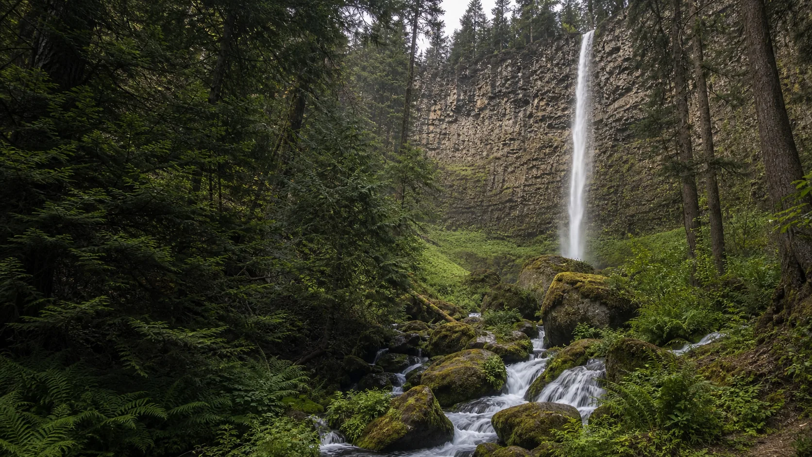
Plan Toketee Falls near Idleyld Park, Oregon: 0.8 mi route details, parking and directions, best time to visit, safety notes, and 8 waterfall photos.
Plan Watson Falls in Douglas County, Oregon: 0.6 mi route details, parking and directions, best time to visit, safety notes, and 8 waterfall photos.
Plan White River Falls near Tygh Valley, Oregon: 0.9 mi route details, parking and directions, best time to visit, safety notes, and 8 waterfall photos.